Google Maps in 2026: The Ultimate Guide to AI Features, Navigation Secrets & Hidden Tricks
Executive Insights
- Google Maps now uses Gemini AI for conversational search and review summarization.
- Immersive View for Routes offers a 3D, photorealistic preview of journeys with weather simulations.
- Sustainable routing has saved millions of tons of CO2 by prioritizing fuel efficiency.
- Lens in Maps uses AR to identify landmarks and businesses through your phone camera.
- The platform has over 1 billion monthly users, maintaining an 80% market share over Apple Maps.
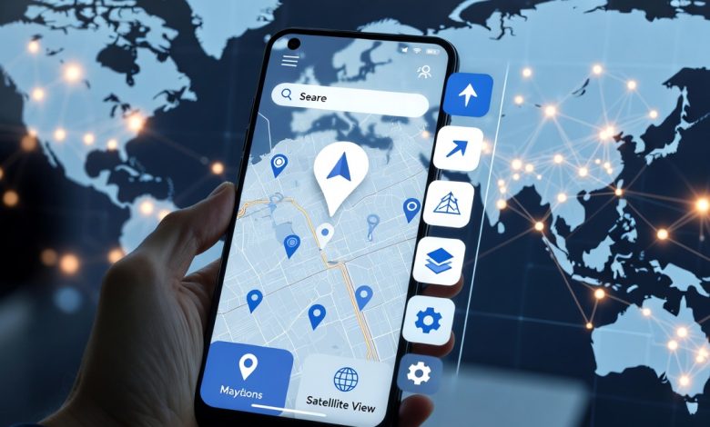
Google Maps has evolved far beyond a simple digital atlas. As of 2026, it stands as the world’s most dominant navigational tool, boasting over 1 billion monthly active users and a market share hovering around 80%. What began in 2005 as a web-based mapping service has transformed into an AI-powered immersive guide, integrating generative AI, augmented reality (AR), and real-time environmental data to reshape how we explore the physical world.
This comprehensive guide dives deep into the latest features like Gemini integration and Immersive View for Routes, while also unlocking hidden navigational secrets that power users swear by.
The AI Revolution: Gemini Meets Maps
The most significant shift in recent years is the deep integration of Google’s Gemini AI. This update moves Google Maps from a command-based tool (e.g., “Navigate to Starbucks”) to a conversational assistant.
- Contextual Search: You can now ask complex questions like, “Find a quiet coffee shop with vegan options and good Wi-Fi near me.” Gemini analyzes millions of reviews and photos to provide a curated list with summarized insights.
- Visual Intelligence: When exploring a new city, you can ask questions about your surroundings using Lens in Maps (formerly Search with Live View). Pointing your camera at a restaurant might reveal an AR overlay showing it’s “highly rated for brunch” or “good for groups,” pulled directly from user sentiment.
- Review Summarization: Instead of scrolling through hundreds of reviews, the AI provides a three-sentence summary of what people love (or hate) about a location, highlighting keywords like “atmosphere,” “parking availability,” or “service speed.”
Immersive View for Routes: A Digital Twin of Your Journey
Immersive View for Routes represents the convergence of Street View, aerial imagery, and computer vision. Rolling out to major global hubs like New York, London, Tokyo, and Paris, this feature allows you to preview your entire journey in a photorealistic 3D environment before you leave.
| Feature | Benefit |
|---|---|
| Time Travel Slider | Visualize your route at different times of day to see simulated traffic jams and weather conditions (rain, lighting). |
| Complex Intersections | See difficult turns in 3D to understand exactly which lane to be in, reducing driver anxiety. |
| Multi-Modal Support | Available for driving, walking, and cycling, showing bike lane availability and sidewalk density. |
Core Features You Might Be Missing
While AI grabs the headlines, the core functionality of Google Maps remains the gold standard for daily navigation. Mastering these tools can save you time and money.
1. Sustainable Routing
Google Maps now defaults to the most fuel-efficient route (marked with a green leaf icon) if the ETA is similar to the fastest route. This feature estimates fuel or energy consumption based on road inclination, traffic congestion, and constant speeds. Since its launch, it is estimated to have saved millions of metric tons of CO2 emissions globally.
2. Offline Maps
Crucial for travelers, this feature allows you to download a specific area for use without data. Pro Tip: Type “ok maps” in the search bar to instantly prompt the download interface for the area currently on your screen.
3. Lists and Emojis
Organize your favorite spots into lists (e.g., “Date Night,” “Hiking Trails”). In a recent update, you can now assign custom emojis to these lists, which appear directly on the map interface, making it easier to visually distinguish between your saved coffee shops (☕) and gyms (💪).
Google Maps vs. Apple Maps vs. Waze
Choosing the right navigation app depends on your priorities. Here is how the top three stack up in 2026:
- Google Maps: The best all-rounder. Unmatched business data (opening hours, phone numbers), superior transit integration, and robust discovery features. Best for exploring and reliability.
- Apple Maps: The design king. Offers a cleaner, less cluttered interface and superior integration with the Apple Watch. Its “Look Around” feature is smoother than Street View but covers fewer countries. Best for iPhone users who want a seamless UI.
- Waze: The commuter’s choice. Owned by Google but operating independently, it focuses purely on shaving minutes off your commute using aggressive crowdsourced data (police traps, potholes, roadkill). Best for rush-hour driving.
For Business Owners: The New Google Business Profile
With the “Google My Business” app retired, all management now happens directly within Maps. For local businesses, ranking in the “Local Pack” (the top 3 map results) is critical.
- 360-Degree Content: With the Trusted Photographer program discontinued, businesses are encouraged to upload their own high-quality 360 photos using 360 cameras (like Ricoh Theta or Insta360).
- AI-Generated Responses: Owners can now use AI to draft polite and professional responses to user reviews, saving time on reputation management.
- Real-Time Inventory: Retailers can integrate their point-of-sale systems to show live product availability directly on their Maps listing (e.g., “In stock: 3 items”).
Hidden Tricks for Power Users
Unlock the full potential of Google Maps with these lesser-known functionalities:
- Parking Reminders: Tap the blue dot showing your location and select “Save parking.” You can even add a photo of the section number or a timer for the meter.
- Measure Distance: Right-click (or long-press on mobile) anywhere on the map and select “Measure distance” to get the exact “as the crow flies” mileage between multiple points.
- Accessible Places: Enable “Accessible Places” in settings to clearly see wheelchair-accessible entrances, seating, and restrooms for listed businesses.
- Incognito Mode: Just like in Chrome, this mode prevents your search history and navigation data from being saved to your Google Account.
Future Outlook: XR and Autonomous Driving
Looking ahead, Google Maps is transitioning into the foundational layer for Extended Reality (XR). As smart glasses regain popularity, Maps is expected to provide the “world-scale” anchor system that allows digital information to persist in physical space. Furthermore, the high-definition (HD) maps being built for Immersive View are the same datasets required to train the next generation of autonomous vehicles, creating a feedback loop where user data improves self-driving safety.
In-Depth Q&A
Q: How do I use Immersive View for Routes?
To use Immersive View, search for a route in a supported city (like London or New York). If available, you will see an ‘Immersive View’ card. Tap it to see a 3D simulation of your trip, including predicted weather and traffic conditions.
Q: Is Google Maps Gemini AI free to use?
Yes, the Gemini AI integration in Google Maps is currently free for all users. It helps with conversational searches and summarizing place reviews.
Q: How does Google Maps calculate the eco-friendly route?
It uses data from the National Renewable Energy Laboratory (NREL) and European Environment Agency, factoring in road grade, traffic stop-and-go patterns, and average speeds to minimize fuel consumption.
Q: Can I use Google Maps offline?
Yes. Search for a city or area, tap the name bar at the bottom, and select ‘Download offline map’. You can also type ‘ok maps’ in the search bar to quick-start this process.
Q: What is the difference between Google Maps and Waze?
Google Maps is a comprehensive tool for exploration, business discovery, and multi-modal transit (walking, transit, driving). Waze is strictly for driving, focusing on crowdsourced real-time alerts like police, accidents, and hazards.